|
|
Post by Admin on Apr 16, 2015 20:58:30 GMT
The official Interim report of March 8th, 2015 asserts MH370 was spotted on radar flying this route: 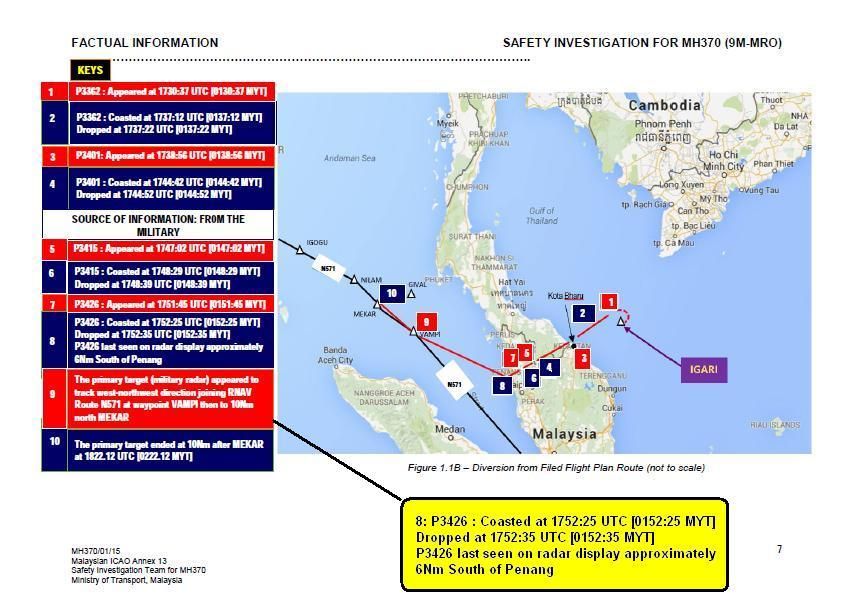 To fly 85nm between a point 6nm south of Penang at 17:52UTC and the island of Pelau Perak -previously asserted in March 2014 at 18:02 UTC, MH370 had to fly at an altitude of not less than 33,000 feet. Why is it therefore that this aircraft was not spotted by Thai military radar at Hat Yai, or by Indonesian military radar at Lhokseumwae? 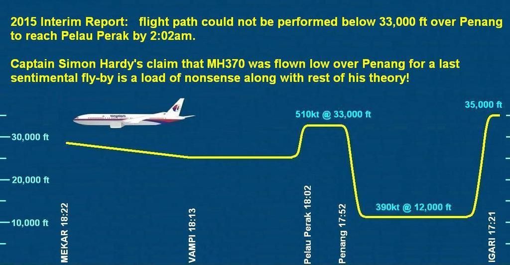 |
|
|
|
Post by birdspeed2 on Jun 14, 2015 8:03:55 GMT
If as I think, the autopilot is out, vertically the aircraft will be following a phugoid profile. Horizontally, a random route. If the above profile is correct, loss In altitude seems to coincide with the turns. This is consistent with wing drop at the top of the phugoid.
Also, if autopilot is out the a/c may exceed normal maximum speeds, so let's not be too dismissive of the ground speeds on some sections of the plot.
|
|


